Robotic mapping
36
MENTIONS
7
EPISODES
7
PODCASTS
Search complete. 36 mentions across 7 episodes found for "Robotic mapping".
Oct 6, 2026

Stephan HrabarGUEST
And then ended up moving to Australia to join the CSIRO, which is a national research lab in Australia and continued working on drone autonomy, eventually adding LiDAR and sometimes radar to drones for doing perception and navigation.
Stephan HrabarGUEST
And then eventually, yeah, just kind of combined the use of LiDAR with SLAM on a drone and saw commercial applications that decided to co-found Innocent and spin out the technology.
Stephan HrabarGUEST
And yeah, kind of gone from there eight years ago.
Jim TatumHOST
Okay, great.
Jim TatumHOST
Well, with, for example, hover map, that's more LiDAR than SLIM or it's a combination thereof.
Jim TatumHOST
Yeah, it's
Stephan HrabarGUEST
SLAM-based LiDAR.
Stephan HrabarGUEST
So we use the LiDAR data in real time.

Artificial IntelligenceNARRATOR
On top of the raw sensors sits the computer vision layer.
Artificial IntelligenceNARRATOR
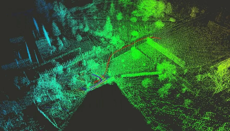
SLAM builds a map of the environment in real time while tracking the drone's position inside it.
Artificial IntelligenceNARRATOR
Visual Inertial Odometry fuses camera and IMU data to hold an accurate position estimate when GPS drops out.
Artificial IntelligenceNARRATOR
This is the machinery that lets a drone stay localized in a warehouse, a tunnel, or a jammed environment.

Chris MatthieuGUEST
And working with NVIDIA and Linux, we built this fully autonomous humanoid.
Chris MatthieuGUEST
So we're running like NVIDIA's KubiSlam, vSlam implementation, And then we added visual odometry, inertial odometry to it.
Chris MatthieuGUEST
So now you can ask Ollie to go to the kitchen and bring you a coffee.
Chris MatthieuGUEST
And it knows where the kitchen is and can navigate through an office space autonomously like normally you see guys hiding behind curtains with joysticks controlling their humanoid where this is fully autonomous that we were able to do with a couple of months working with NVIDIA and Linux which is pretty awesome and You know, you turn the camera, you know, full 360 and Intel's, you know, back in the robotic space.

Weihan WangGUEST
at NexCobot.
Erik ReynoldsHOST
He's got more than 15 years in industrial robotics, starting in mobile robots and SLAM research, and then moving on to PC-based robot controllers and functional safety.
Erik ReynoldsHOST
So like many of us coming into functional safety as a result of our careers.
Erik ReynoldsHOST
He's safety manager for the SCB100 safety controller.
Weihan WangGUEST
So it's almost 17 years.
Weihan WangGUEST
Yeah.
Weihan WangGUEST
So before I start, I actually studied SLAM, the localization, simultaneously localization and mapping in my master degree.
Weihan WangGUEST
So my research topic is actually underwater robot SLAM.

Artificial IntelligenceNARRATOR
Running detection on the drone's own camera feed rather than a laptop webcam, so the operator doesn't need to be at a base station.
Artificial IntelligenceNARRATOR
and fusing gesture intent with onboard autonomy so a gesture sets a goal and the drone figures out the path itself, which connects directly to the perception and navigation stack I've written about in VSLAM for autonomous UAVs and to the hands-on control work in my RC Drone Reverse Engineering series.
Artificial IntelligenceNARRATOR
The takeaway, hand landmark detection is a solved, one import problem.
Artificial IntelligenceNARRATOR
That's exactly why it's misleading, the tracking overlay looks like the finished product when it's really the first of three stages.

Shane BrennanGUEST
This is only really useful when you can apply it to, in the context of a moving vehicle.
Shane BrennanGUEST
If you can apply this using what's called simultaneous localization and mapping, or SLAM for short.
Shane BrennanGUEST
For those who don't know what SLAM is, basically it's an algorithm that allows you to move through an environment and map it at the same time.
Shane BrennanGUEST
So basically, at each frame, your sensor has its own local reference system, which is pretty useless for creating a map, but what it does is the SLAM algorithm takes It grabs features such as the corners of buildings, street lights, what have you.
Shane BrennanGUEST
And it can recognize that on following frames.
Shane BrennanGUEST
And so it's able to say, OK, I've moved 10 feet here.
Shane BrennanGUEST
And that's how we get those those images really easily out of that sensor.
Shane BrennanGUEST
But so as I mentioned, the sensor data can be both representative point cloud and a panoramic image.