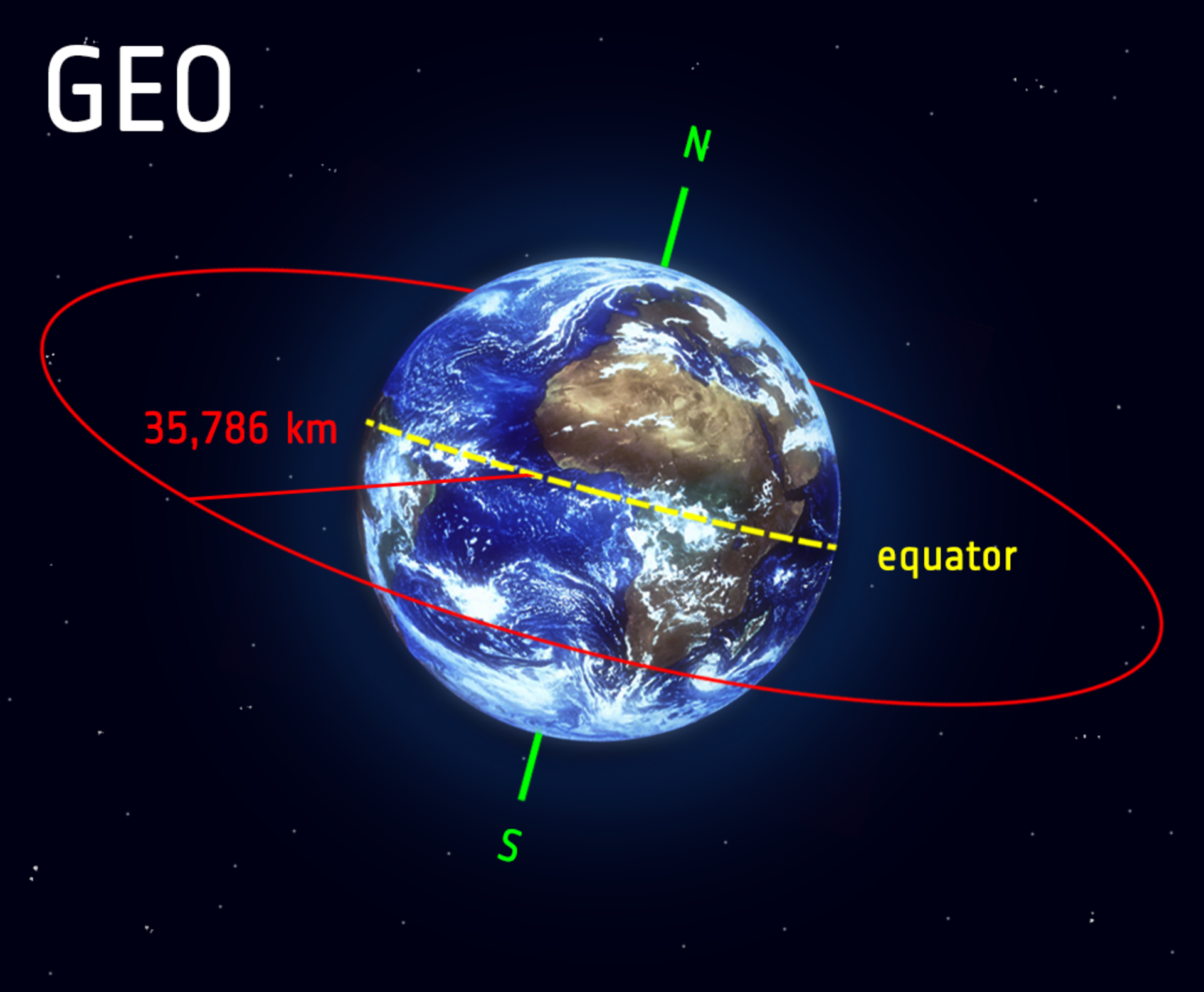
Geostationary orbit
Kind of orbitWikipedia
17
MENTIONS
7
EPISODES
7
PODCASTS
Search complete. 17 mentions across 7 episodes found for "Geostationary orbit".
Oct 13, 2026

SimeonHOST
The laser, Theodore Maiman, 1960.
SimeonHOST
Geostationary communications satellite, Harold Rosen, 1963.
SimeonHOST
Drip irrigation, Simcha Blass, Netafim, 1966.
SimeonHOST
Personal computer, CPU central processing unit, 1979, designed at Intel's Haifa Laboratory.

speaker_0HOST
Let's add some context there for the listener.
speaker_0HOST
Geostationary orbit, or GEO, is roughly 22,000 miles above the Earth's equator.
speaker_1HOST
Yes.
speaker_0HOST
At that specific altitude, a satellite's orbital speed exactly matches the rotation of the Earth, meaning it effectively hovers over the exact same spot on the ground permanently.
speaker_1HOST
It is absolute prime real estate for crucial telecommunications and early warning military satellites.
speaker_0HOST
So this Chinese satellite in GEO approaches an old, dead Chinese satellite.
speaker_0HOST
It uses its robotic arm to grapple the dead satellite, fires its thrusters, and literally tows the dead satellite hundreds of miles further out into space.
speaker_1HOST
Dropping it into what is known as a graveyard orbit to get it safely out of the way.

Mark KeremedjievGUEST
Uh, but what's really great is 10 years from now, we're gonna move even further beyond just the infrared and visible imaging, right? We're gonna move into a whole bunch of other modalities.
Mark KeremedjievGUEST
We expect we'll do a weather monitoring, where we're gonna look at the next class of weather satellites, where you can look at augmenting or even enhancing the GOES capabilities from GEO.
Mark KeremedjievGUEST
Uh, we'll look at being able to do hurricanes, severe convective storms, these other things that people really care about.
Mark KeremedjievGUEST
But then we're gonna have some fun looking at even more, uh, elaborate and enhanced things.
Mark KeremedjievGUEST
Uh, and that gives, that kind of information is tremendously valuable to them.
Mark KeremedjievGUEST
And that's just not something that satellites and LEO provide, right? It's really hard to get a collection of, of high frequency.
Mark KeremedjievGUEST
So I thought, "Well, wouldn't it be neat if you had a satellite in GEO where you could do the entire Permian Basin, you know, once every 15 minutes," right? Map the entire Permian Basin and detect methane from there.
Mark KeremedjievGUEST
Um, and that was kind of, got me starting to think about, "Oh, okay, what would you need for that?" You know, can...

Paul MayerHOST
They currently operate the largest commercial quote non-Earth imaging network In so many words, they've got access to about 50 sensors and cameras on orbit.
Paul MayerHOST
So this $25 million is going to accelerate HEO's expansion into both LEO and GEO orbits.
Paul MayerHOST
And they've already booked their first two GEO launches slated to start in quarter four of 2026 and plan to establish reliable, repeatable GEO imaging by as early as first half 2027.
Paul MayerHOST
So they're moving pretty quickly as far as getting these capabilities and expanding their fleet of sensors and operating vehicles as rapidly as they can.
Paul MayerHOST
Now, they've got some software offerings.
Harrison LambertHOST
HEO started out as a robotics company, but they have only been talking about space domain awareness as of recent.
Harrison LambertHOST
It seems like that's going to continue with this new funding round.
Harrison LambertHOST
And pushing into GEO is kind of the natural extension of that.

speaker_0HOST
If an adversary can use these gravitational currents to sneak up on our most vital satellites, how on earth do we even spot them in a volume of space 1,700 times bigger than our normal neighborhood?
speaker_1HOST
Well, the United States Space Force recognized that their legacy defensive perimeter was dangerously inadequate.
speaker_1HOST
To adapt, they formally extended their area of responsibility outward into what Doctrine calls extra-geosynchronous space, or XGEO.
speaker_0HOST
And they set up a whole new unit for this, right? Yeah.
speaker_1HOST
Space Delta II established the 19th Space Defense Squadron down in Dahlgren, Virginia.
speaker_0HOST
And beyond.
speaker_1HOST
And beyond, yeah.
speaker_1HOST
The mandate is to prevent XGEO from becoming an unmonitored sanctuary.

speaker_1HOST
And this is undeniably a multipolar race.
speaker_1HOST
India recently completed a highly successful launch of their EOS-05 geostationary Earth observation satellite.
speaker_0HOST
Geostationary is a tough orbit to hit.
speaker_1HOST
Achieving geostationary orbit, which requires inserting a satellite 22,000 miles above the equator so it matches the Earth's rotation, is a major technical benchmark.
speaker_1HOST
It is absolute proof that advanced access to space is expanding globally.