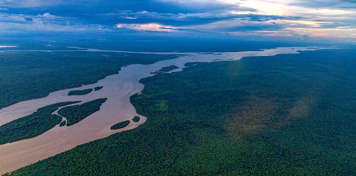
Essequibo River
River in GuyanaWikipedia
7
MENTIONS
5
EPISODES
5
PODCASTS
Search complete. 7 mentions across 5 episodes found for "Essequibo River".
Sep 14, 2026

Laura BinghamGUEST
There was, they're almost like laughable in, they're serious in the moment, but kind of laughable after that.
Laura BinghamGUEST
So they were in the Essequibo.
Laura BinghamGUEST
There was one morning that I woke up and I could just hear everyone going,
Stephen KellyHOST
Jaguar, Jaguar.
9 MINS LATER
Stephen KellyHOST
my
Laura BinghamGUEST
mentality was pushed to a limit.
Laura BinghamGUEST
But, and then the Essequibo, I remember having my period and standing on a rock and telling everyone to leave me there to die.
Laura BinghamGUEST
which was probably slightly dramatic.

speaker_2NARRATOR
There is naturally little chance to do so, and we don't know how to use it when it comes.
speaker_2NARRATOR
I remember that when a chance did come in connection with the great Venezuela dispute over the ownership of the jungles and mudflats of British Guiana, the American papers at once inserted headings, Where is the Essequibo River? That spoiled the whole thing.
speaker_2NARRATOR
If you admit that you don't know where a place is, then the bottom is knocked out of all discussion.
speaker_2NARRATOR
But if you pretend that you do, then you are all right.

Stephen FevrierHOST
Painting a picture with words alone for millions who will never see the pitch, and few have practiced it longer or with greater devotion than today's guest.
Stephen FevrierHOST
His story begins in Pomeroon, Essequibo, deep in Guyana's interior.
Stephen FevrierHOST
The fifth of nine children of a farmer, a boy who dreamed of the microphone, though a stammer stood in his way.
Stephen FevrierHOST
He taught himself to breathe through the starts of words and sentences, and went on to call the game for nearly 60 years, 152 test matches, and five World Cups, building the very game he animated with his words as an administrator in Guyana and across the OECS.
9 MINS LATER
Stephen FevrierHOST
Mm.
Joseph Reds PerreiraGUEST
40 people in the bus.
Joseph Reds PerreiraGUEST
And go to Adventure, we catch the steamer, and we cross the Essequibo River.
Joseph Reds PerreiraGUEST
The mouth is 20 miles wide.

Brian HallGUEST
For the transportation of the mission workers, it depends on where you're going as to what mode of transportation you use.
Brian HallGUEST
The last trip I was across the Essequibo River, which is like 20 miles across at the mouth, and we used the large ferry.
Brian HallGUEST
because it holds all of your stuff and a couple of vans and things like that.
Brian HallGUEST
Sometimes you go across a ferry, and it's a pontoon, and you pull yourself across.

Larry WilsonNARRATOR
Part 1 comprises 15 maps all printed on the same base.
Larry WilsonNARRATOR
This base map was specially compiled and engraved for the Commission and is designed to represent the latest and best information as to the natural features of the Orinoco-Essequibo region.
Larry WilsonNARRATOR
It is based chiefly on the so-called Great Map of the Colony, dated 1875, and published by E. Stanford of London in 1877.
Larry WilsonNARRATOR
Various other maps were also made use of in its compilation.